| Solo 6 | |
| Flight time logged: | 3.1 hours |
| Total flight time logged: | 41.1 hours |
| Total takeoffs/landings: | 131 |
| Solo time: | 3.1 hours |
| Total time solo: | 9.4 hours |
| Total cost to date: | $6480 |
What a trip! I followed up my last short solo cross country flight with a long cross country flight. For the long cross country, you are required to fly a minimum of three legs with one leg at least 50 NM long and the total length at least 150 NM. You also must land at three of the points. I flew from LZU to 9A1 (Covington) to HQU (Thomson-McDuffie) to IIY (Washington-Wilkes) then back to LZU.
After some delays and an extensive pre-flight, I took off from LZU towards 9A1. The winds were gusting a little by the time of my takeoff, so I had to use my crosswind takeoff skills. Once I got on course it was not long before I could see the Covington airport. Since this leg of my flight was short, I decided not to get flight following until the next leg. I did open my flight plan once I was outside of the LZU class delta airspace.
As I approached Covington, I radioed my position and my landing intentions.
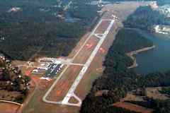 Covington does not have weather reporting, so I had to rely on the latest ATIS from LZU and looking at the windsock on the field at Covington. As I entered the downwind for Runway 28, I noticed another plane at the hold line for Runway 10. I asked the pilot for wind information since he was on the ground and had a better view of the windsock. He stated that the wind was a direct crosswind at a few knots and that either runway could be used. He suggested that landing on Runway 10 was easier. Given that construction crews were working on the threshold of Runway 28 (making the runway 500 feet shorter than normal), I quickly decided to leave the pattern and re-enter the downwind for Runway 10. I announced my intentions and re-entered the downwind for Runway 10. As I came down on final approach, I felt that I was too high and decided to go around. On my second circuit around the pattern, I lengthened the approach to give myself more time to descend. This time I came in too fast and floated along in ground effect. I felt that I would not have enough runway length to stop due to the construction, so I did another go around. Finally, on my third landing attempt, I came in just right and landing without a problem. After a quick taxi back to Runway 10, I took off towards HQU.
The leg to HQU was the longest leg. As I leveled off at 3,500 feet, I called for flight following. Finding my checkpoints on the way was really easy. There were several good landmarks to choose, not to mention I was flying parallel to Interstate 20. About half-way to HQU, I started to smell smoke. I knew it was not from the airplane, but from wood burning outside. I looked over to my right and saw a forest fire. The smoke was somewhat reducing visibility. I began thinking that I would have to descend to maintain visibility with
 the ground. Before long, though, the smoke cleared. Not too long after, I had HQU in site and flight following was terminated.
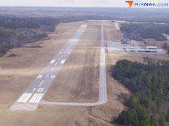
I entered the pattern at HQU and made a perfect landing. After taxiing off the runway, I remembered that I needed to close my flight plan and open the flight plan for the return flight. I should have done this before entering the pattern. I tried to call the flight service station from the ground but had no luck. I immediately prepared the cockpit with my chart, nav log, and necessary items for the return legs. I wanted to get back up in the air quickly in order to close my flight plan on time. I took off from HQU and headed for IIY.

As I was climbing, I tried to contact the FSS again. I could not get anyone to respond, so I tried a different FSS frequency. It happened to be the Anderson FSS and not the Macon FSS, but I did get a response. They assisted me by relaying my request to the Macon FSS to close my flight plan to HQU and open my flight plan back to LZU. By this time, I could see the Washington-Wilkes (IIY) airport. I started my descent to get in the pattern. Again I had a good landing. I taxied back to take off again, this time towards home - LZU.
On the
 leg home, I used flight following again. I flew at 4,500 feet back to LZU. It was pretty uneventful. As soon as I parked the plane, I closed my flight plan. I was excited that I completed my first long flight by myself. It was a real confidence booster.
